A large walled 5th century monastery and pilgrimage inn, with huge underground water reservoirs. Founded by the hermit Euthymius “the Great”
Home > Sites > Judea > Euthymius Monastery, Mishor Adummim
Contents:
Background
Location
History
Photos
* Aerial views
* Exterior
* Gate
* Courtyard
* Inn
* Crypt
* NorthEast
* Church
* Water
Links
Etymology
Overview:
A 5th century AD monastery in Mishor-Adummim, on the road from Jerusalem to Jericho and the Jordan valley. It was founded by the hermit Euthymius “the Great” in 428AD as a Laura (or Lavra – a monastery of hermits, with small cells). In 482, after the death of the founder, it changed to a larger, communal form (Coenobium – a walled monastery). Recent excavations restored the large monastery and its immense water supply complex, making it an attractive and accessible archaeological site which sheds light on the Judean desert monasticism.
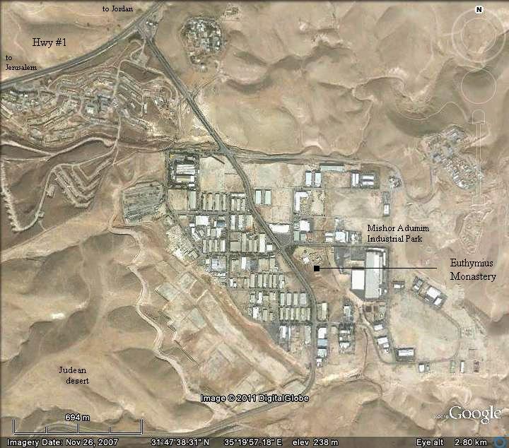
Location and Aerial map:
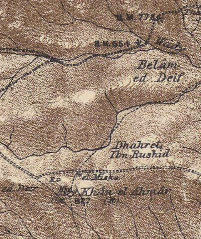
The site is located in Mishor-Adummim, the industrial park near Ma’ale Adummim, east of Jerusalem. It is at an altitude of 240m above sea level. The monastery is located 2km south of the ancient road from Jerusalem, and served as a road station.
An ancient access road to the monastery, which used to connect to the Jerusalem road, is now gone. It followed a course from a north-west junction (seen on the top-left side of the map). A tower (“Qasr el-Khan” – fortress of the inn) was located along the access road, about 300m NW of the monastery, but it too was demolished during the development of the Industrial park.
History of the place:
- Euthymius (377-473) – Founding father
|
Euthymius (also: Euthemius) was one of the most prominent fathers of the Judean Desert Monasticism, and often called “St Euthymius the Great”. He was born in Melitea in Armenia (a land east of modern Turkey) to a noble family, and until the age of 29 was in charge of the monasteries in his home region. He came to the Holy Land as a Christian pilgrim (406), and then moved to the Laura of Faran (Pharan, in Wady Qilt), which was directed by the monk Chariton. After five years, at the age of 34 (411AD), he moved with his fellow hermit Theoktistus to a cave located on the cliffs of Nahal Og (Wadi Mukelik in the upper section of Og). Later, more hermits joined them to form a monastery in the form of a Coenobium – the first in Judean desert. |
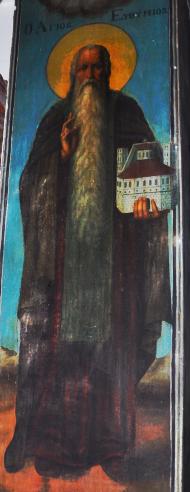 Euthymius – painting in St. Gerassimos Euthymius – painting in St. Gerassimos |
He became famous for healing a son of a Arab leader, and many hermits gathered around him. To further stay in solitude, Euthymius relocated after 10 years (421) with a fellow hermit Domitian to the ruins of Masada (“Marda”), forming the core of a new Laura. He then moves to caves near Tell-Ziph, southeast of Hebron, where he establishes the coenobium of Capar Baricha (near Beni Na’im).
The crowds continued to follow him, so he returned to Monastery of Theoktistus. Once again, due to his immense popularity, the solitary-seeking hermit moves to anther cave west of the Monastery of Theoktistus, a site closer to Jerusalem, located on the side of the main road known as Adummim (Reds).
In 428 he established here a monastery of hermits (Laura) known as the Monastery of Euthymius, based on the model of the Laura of Faran.
In 451 the city of Chalcedon (Turkey) hosted the Fourth Ecumenical Council. The resolutions caused a split among the hermits. Euthymius who was “pro-Chalcedonian”, sided with the resolutions of the council, condemning a doctrine called Monophysitism. His support convinced many of the “rebelling” hermits to accept this orthodox stand.
-
After Euthymius
Euthymius died at the age of 97 (475). A few years after his death, the Laura was changed to Coenobium in 482 AD. The Coenobium (pronounced Coi-Noi-Bee-Yum) was a communal monastery, where a number of structures were surrounded by a wall and the monks lived there in a commune. The monks lodged inside the compound and followed a strict daily schedule. The walled complex was built around the location of the Laura’s old Church, and a new one was built over it.
This word is based on the Greek words Koinos (common) and Bios (Life). The emphasis of this form is the community life, in contrast with the solitary living of the hermits which was too lonely and often led to mental breakdown. It was larger, more disciplined than the Laura, and followed a daily schedule. For many hermits, it was the first station before wandering to the desert or joining a Laura.
A guest house was also added on the south side of the complex, servicing as an inn for the pilgrims who traveled along the Adumim road.
The monastery and its events were documented by the biographer of Euthymius, Cyril of Scythopolis, who lived here for 10 years (545-555). His testimony (Life of Euthymius or “Kyrillos von Skythopolis”) provides a valuable, first hand, source of information.
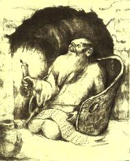
Hermit in a cave – drawing by Rina
-
After the Byzantine period
The monastery was not damaged by the 638 century Islamic conquest, unlike most of the Christian sites. However, it was severely damaged in the 659 earthquake, and most of it was rebuilt within several years.
During the Islamic period, the monasteries in Judean desert were frequently attacked. In 809 this monastery, as well as others, was plundered, resulting in a severe damage. The monastery was finally destroyed in the 12th century.
Some parts of it were repaired during the Crusaders period (13th century), but it survived only until the Mameluke period (13th-16th century).
-
Ottoman period
After the Mameluke period the site was in ruins, although it continued to serve as a station (Khan) along the road to Nebi Musa and the Jordan. It was called the “Red Inn” (Arabic: Khan el-Akhmar), named after the name of the road (Adummim – red, named after the color of the rocks in the lower section of the road).
In 1873, the surveyors of the PEF (Palestine Exploration Foundation) visited the ruined site and reported on the ruins of the hostel (SWP – Sheet XVIII, p207):
“The ruins of a Saracen hostel beside the old road to Jerusalem. It … has large cisterns supported on arches beneath, on the east. A few courses of the walls are standing ; the masonry is of moderate size and well
dressed”.
Part of Map Sheet 187 of Survey of Western Palestine,
by Conder and Kitchener, 1872-1877.
(Published 1880, reprinted by LifeintheHolyLand.com)
-
Modern period
Excavations started in 1928 by D. J. Chitty, who focused on the church and crypt. In the 1970s Yiannis Meimaris continued the excavations in the refectory near the church. In 1987 Y. Hirschfeld and R. Birger-Calderon renewed the site-wide excavations. Further excavations, preservations and site development is carried out in the recent years by the archaeological staff for Judea and Samaria and the Conservation Department of the Israel Antiquities Authority.
The site is open to the public and is a recommended place of interest along highway #1.
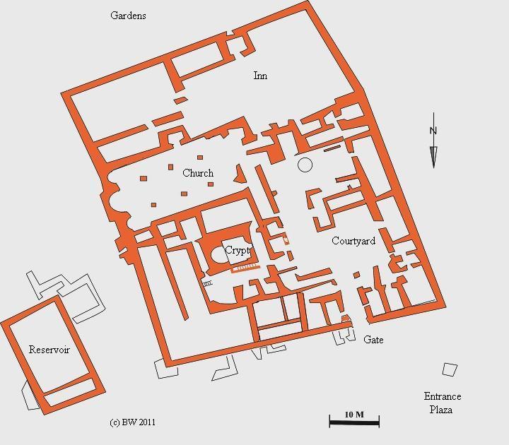
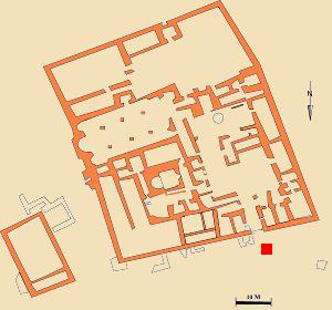
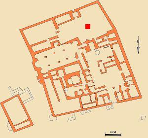
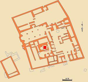
Plan:
A plan of the monastery is shown below. The main entrance to the walled complex is from the north-west gate.
The hermit cells of the Laura were located outside the walled area. The Laura had a total of 12 cells, but only three were found at nearby locations (two cells are located 40m south of the southwest corner, and another cell 80m southeast of the southeast corner). Perhaps other cells are buried under the ruins.
Photos:
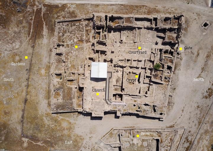
(a) Aerial Views
A drone view, with the west on the upper side, shows the monastery complex from the bird’s view.
Click on the photos to view in higher resolution…

The major points of interest are marked on the aerial view.
![]() The following YouTube video shows a flight over the site:
The following YouTube video shows a flight over the site:
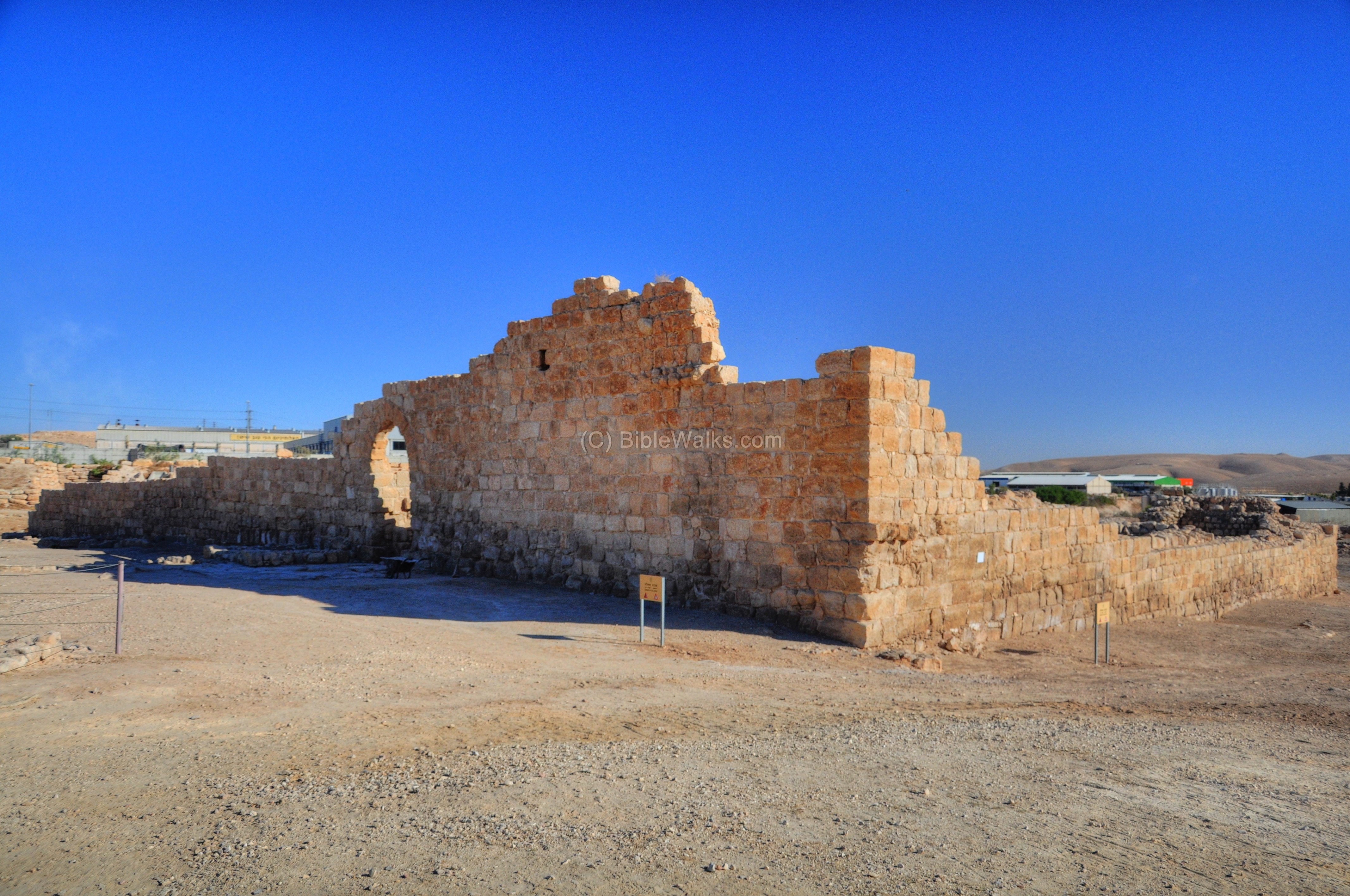
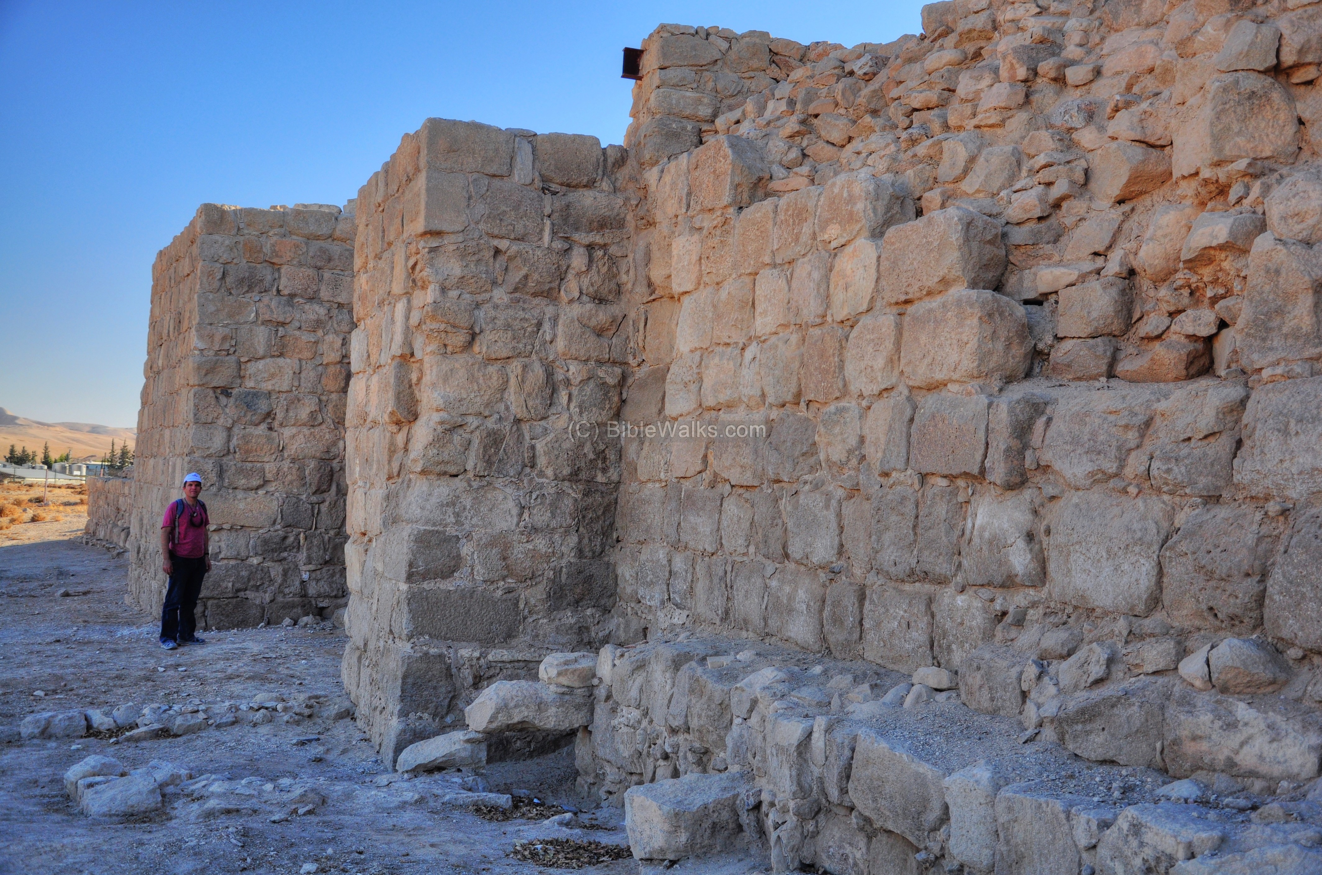
(b) Exterior
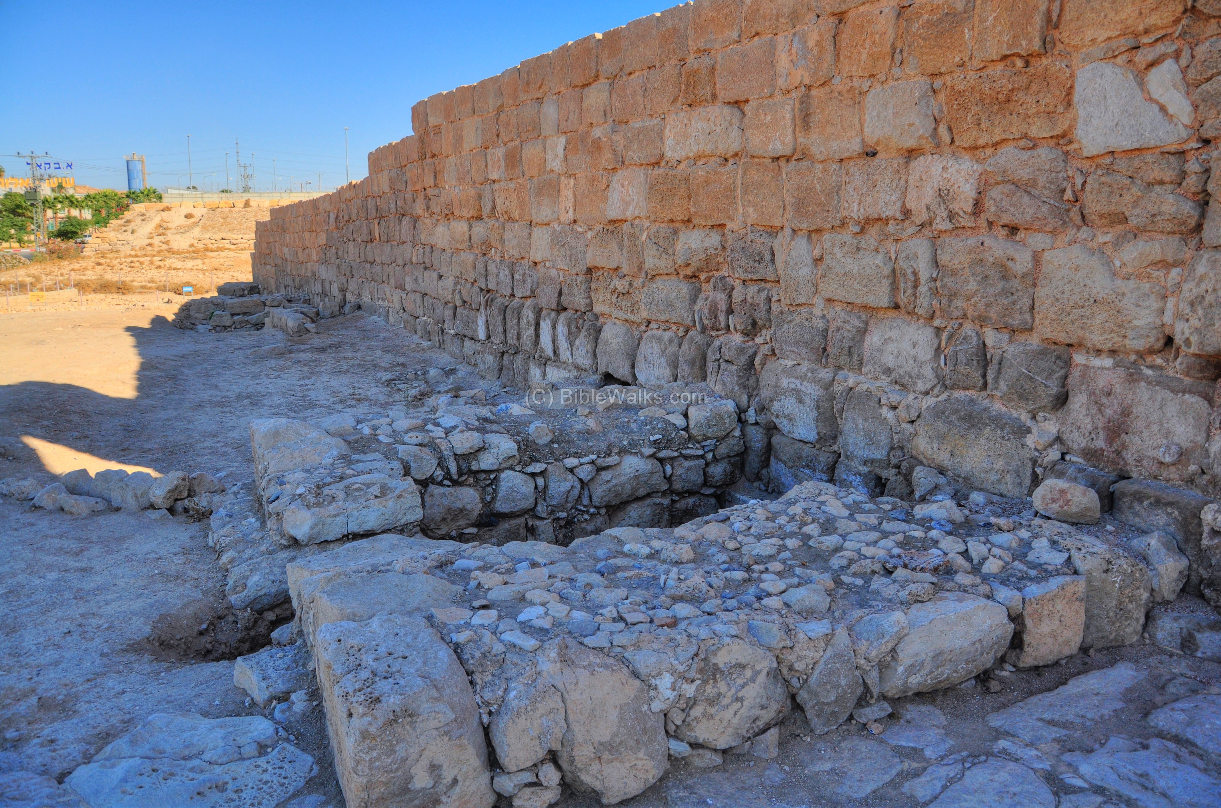
The northern and western walls of the monastery are seen in the picture. The wall, 6m high, encompasses an area of 54m by 65m, and provided protection for the monks. The arched entrance is located on the north side.
A section of the north wall, on the side of the gate, is in the following view. The cistern in front of the wall is part of the water system which was fed by a water channel from nearby cisterns.
The next photo shows a section of the eastern walls.
(c) Entrance
The arched entrance to the monastery is from the north side, close to the western corner. It is marked on the right as a red square.
The gate is 3.2m high and 2.1m wide. According to its design, it is probably dated to the Crusaders period (12th-13th century).
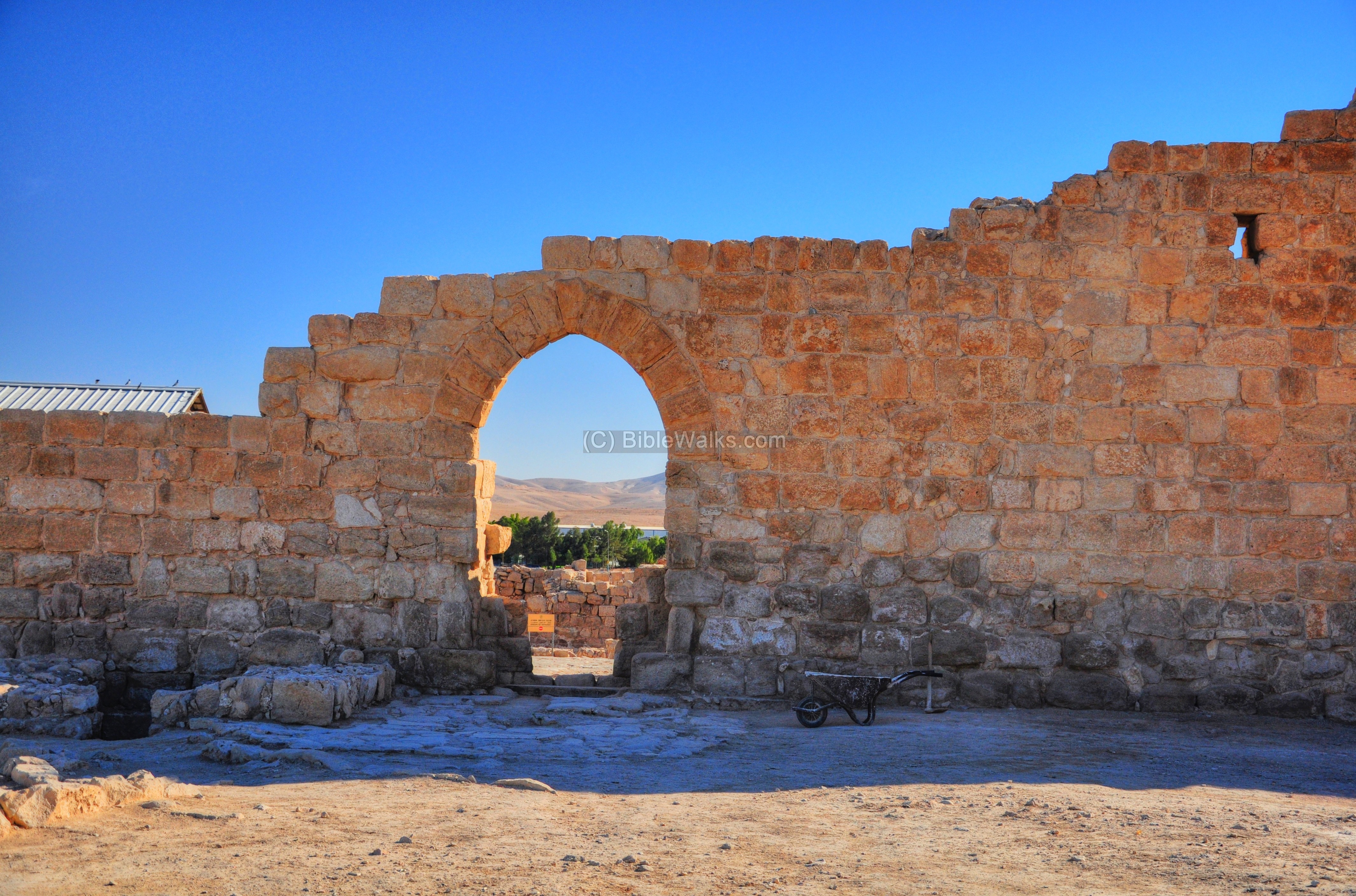
A view of the entrance, as seen from inside out, is in the next picture. It is evident from this side of the gate that the monks were well protected, and were capable to defend themselves against external attacks. After all, this remote area was not safe, and the hermits had to protect themselves. During times of raised security, the monks left the gate sealed, and used a wooden device on the north-west corner to raise supplies over the wall using a rope and basket.

Behind the gate, on both sides, are storage rooms and chambers for the monks.
(d) Courtyard and Western side
In the center of the monastery is a courtyard, as marked on the plan with a red square. The floor is paved with well fitted stone slabs.

The following picture shows a north-west view of the entrance and the courtyard area behind it.

The next picture is a closer view of the floor of the main courtyard, as seen from the entrance.

Behind this courtyard, further to the south, is another open section:
The next picture shows a western view towards this section, as seen from the top of the church:
(e) Inn
On the south side of the monastery is a large area (54m x 20m). It is marked as a red square on the plan:
The area probably served as an inn, or hostel, for pilgrims and travelers of the Jordan-Jerusalem road. This was one of the main sources of income for the monastery, in addition to donations and funding by different organizations. It was a common element in the design and objectives of the monasteries.
The entrance to this area is from an opening in the wall, behind the small room on the left in the picture below.
In the area south of the inn (seen in the top-left corner, and beyond) there are remains of two large gardens. Their total area is 2500 m2, and they were surrounded by low walls. In these gardens the monks grew fruit trees and vegetables. Beyond them, there are scarce remains of some of the hermits’ cells which were part of the first stage of the monastery (the Laura, 428-482).
(f) Burial crypt
In the center of the complex, under the ground level, is the burial crypt. The crypt contains a number of chambers of rock-cut and built tombs, which are covered by stone slabs. After Euthymius died, his bones were stored in this crypt. Additional senior monks and abbots were buried in the other graves.
A small chapel (8.8m x 8.4m) was built on top of the crypt during the Crusaders period. Its ruins are seen on the left side of the picture below, and the crypt is located under these remains.
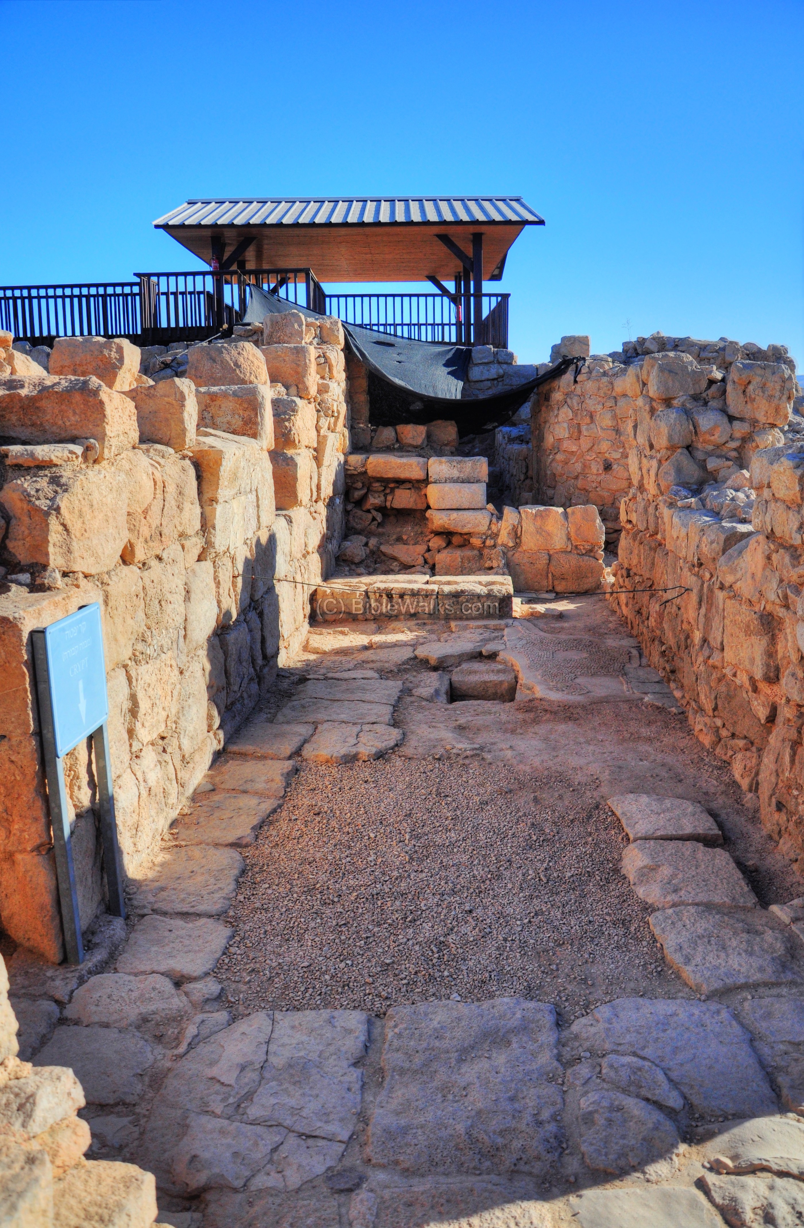
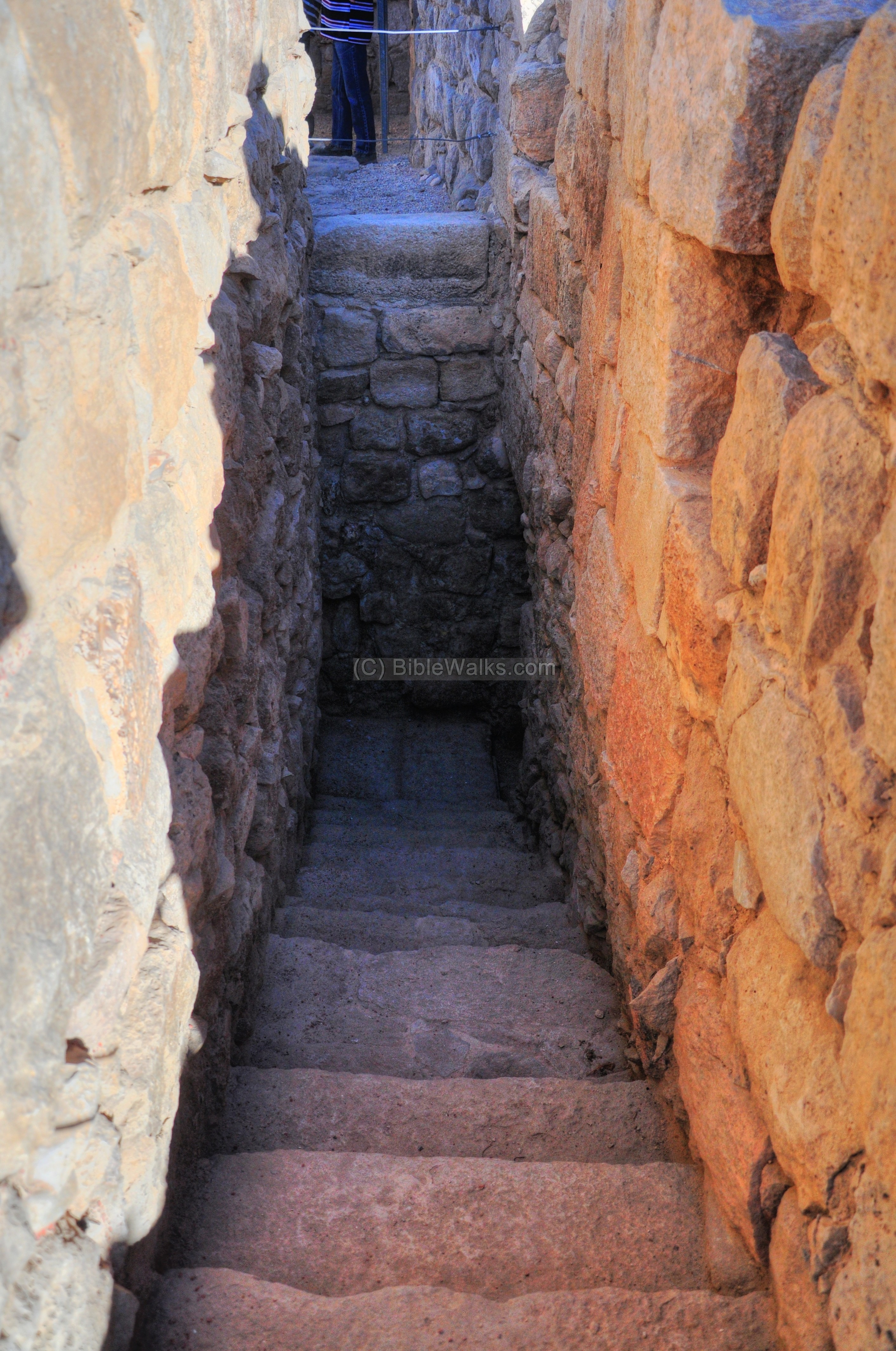
On the north side of the crypt is a narrow staircase with 13 steps that leads down to the entrance of the crypt.
The crypt has two underground halls:
-
Main burial hall on the east side (size: 4.7 x 5.8m x 3.5 high), with additional 2 smaller niches at the edge of the hall. The staircase reached its north-east corner. This is the place of the grave of Euthymius and abbots of the monastery.
-
Additional burial hall on the west side (size: 8.5m x 2.4m). This was the place of burial for senior monks.
The burial crypt with the grave of Euthymius “the Great” was the major attraction in this monastery. Pilgrims came here to visit the grave and pay respect to the great hermit.
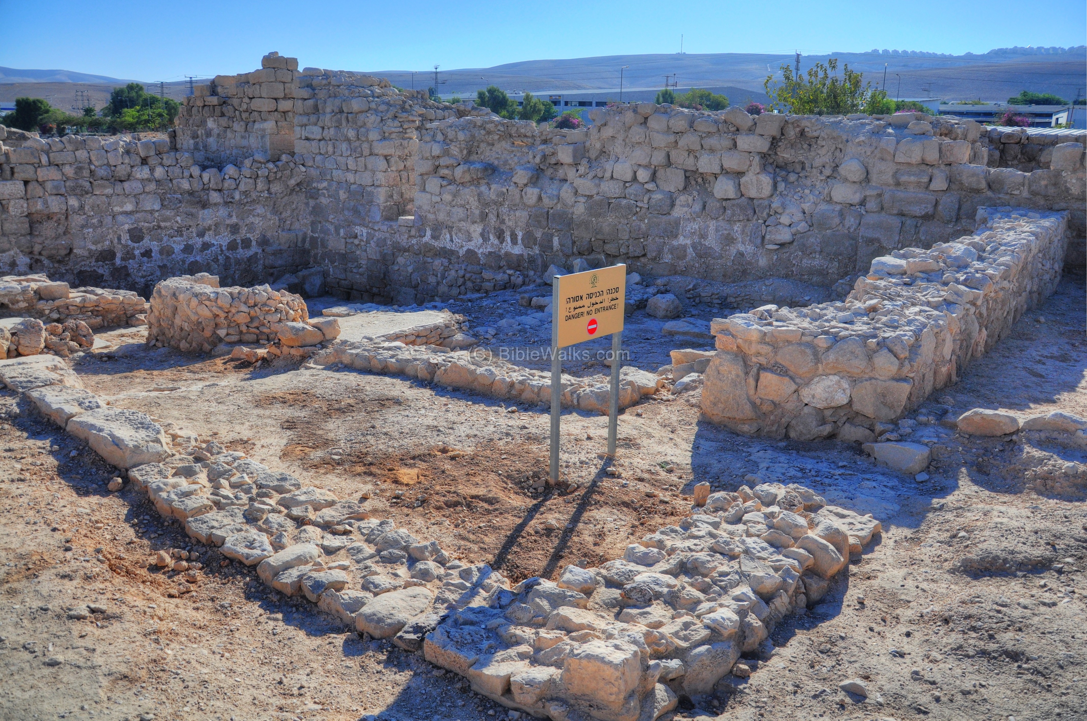
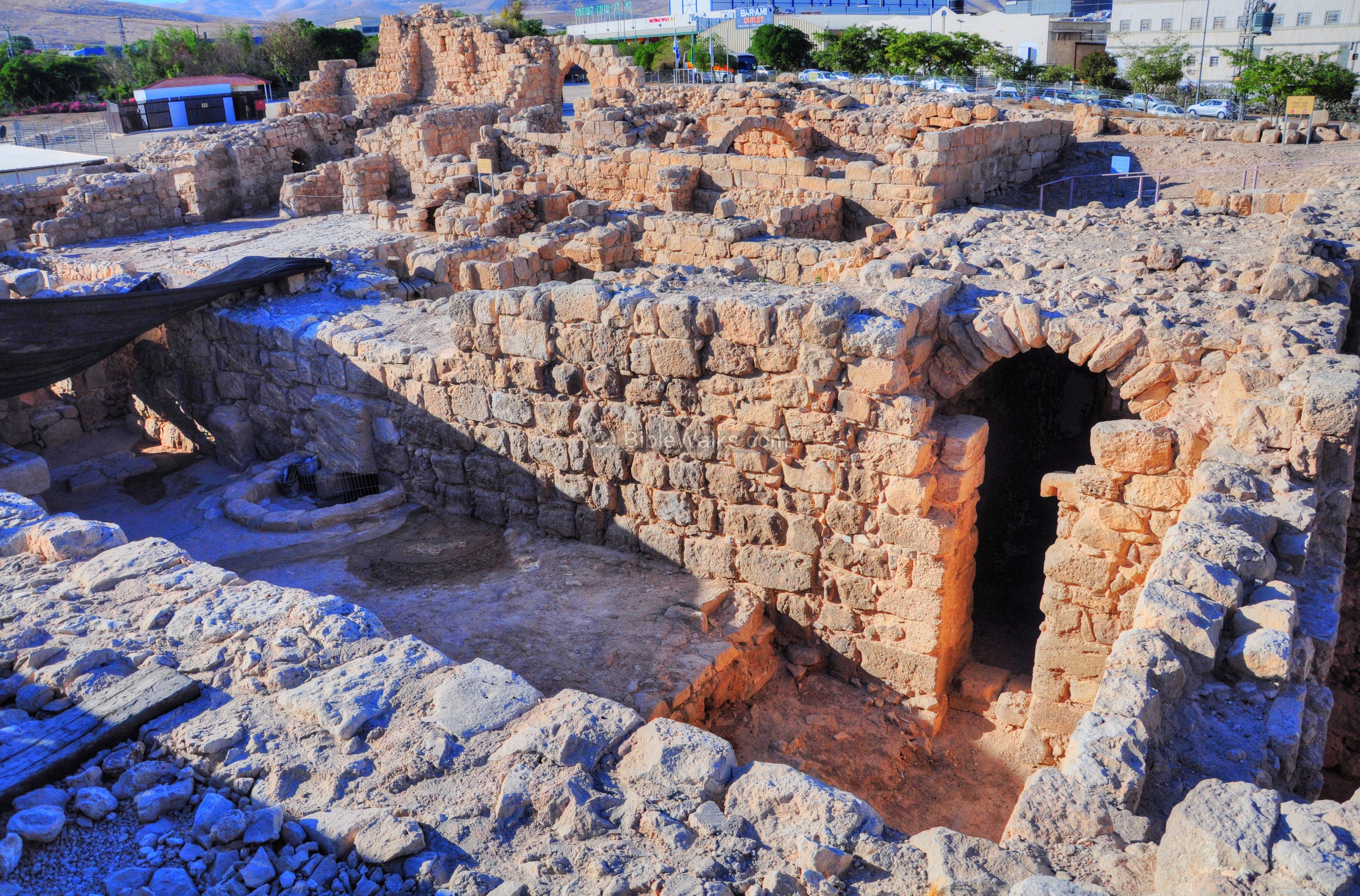
(g) North Eastern section
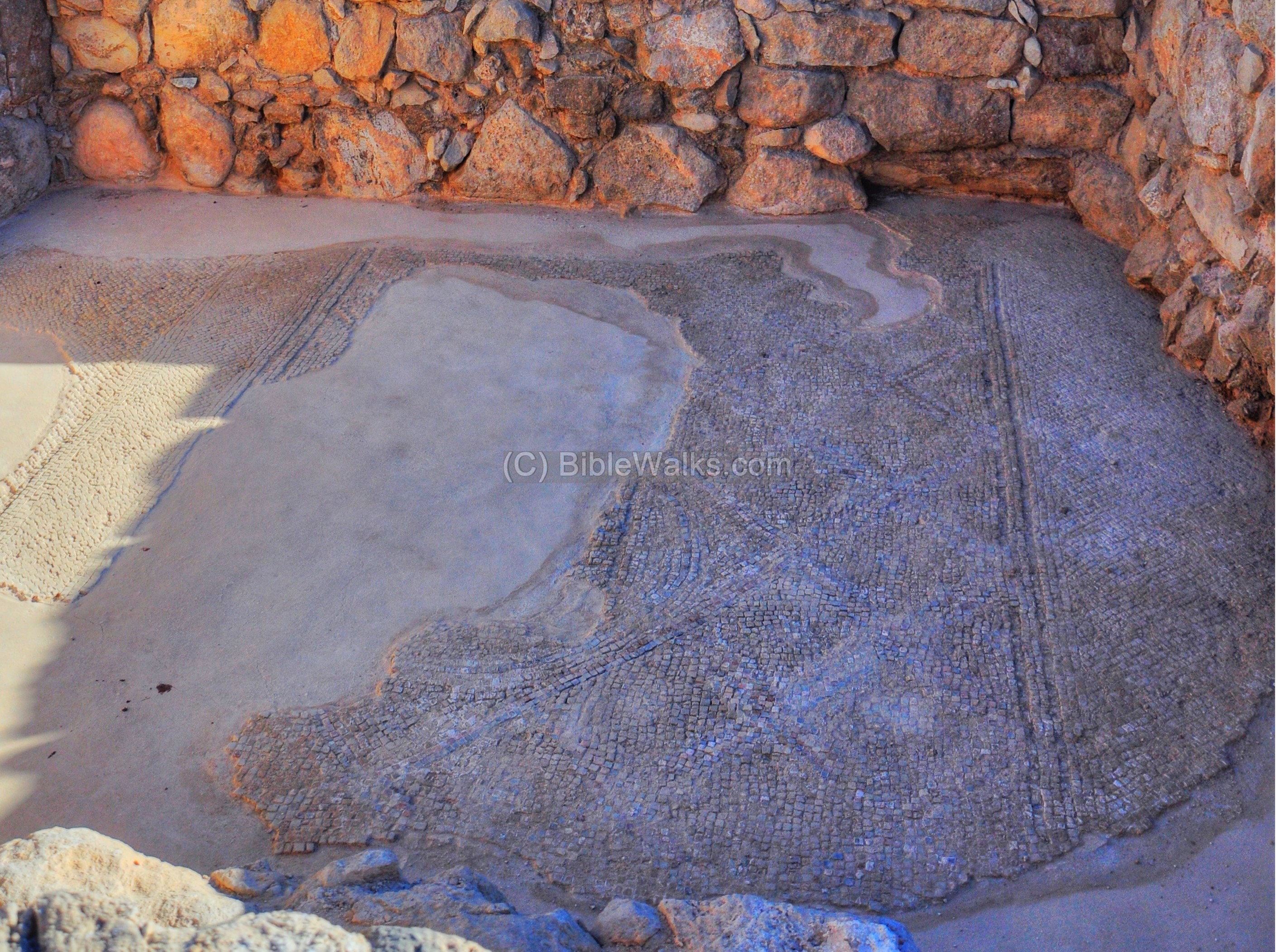
The monastery was built two stories high. A flight of steps lead up from the corridor near the crypt. The floor was supported above arched vaults and walls, creating the residential rooms of the monks.
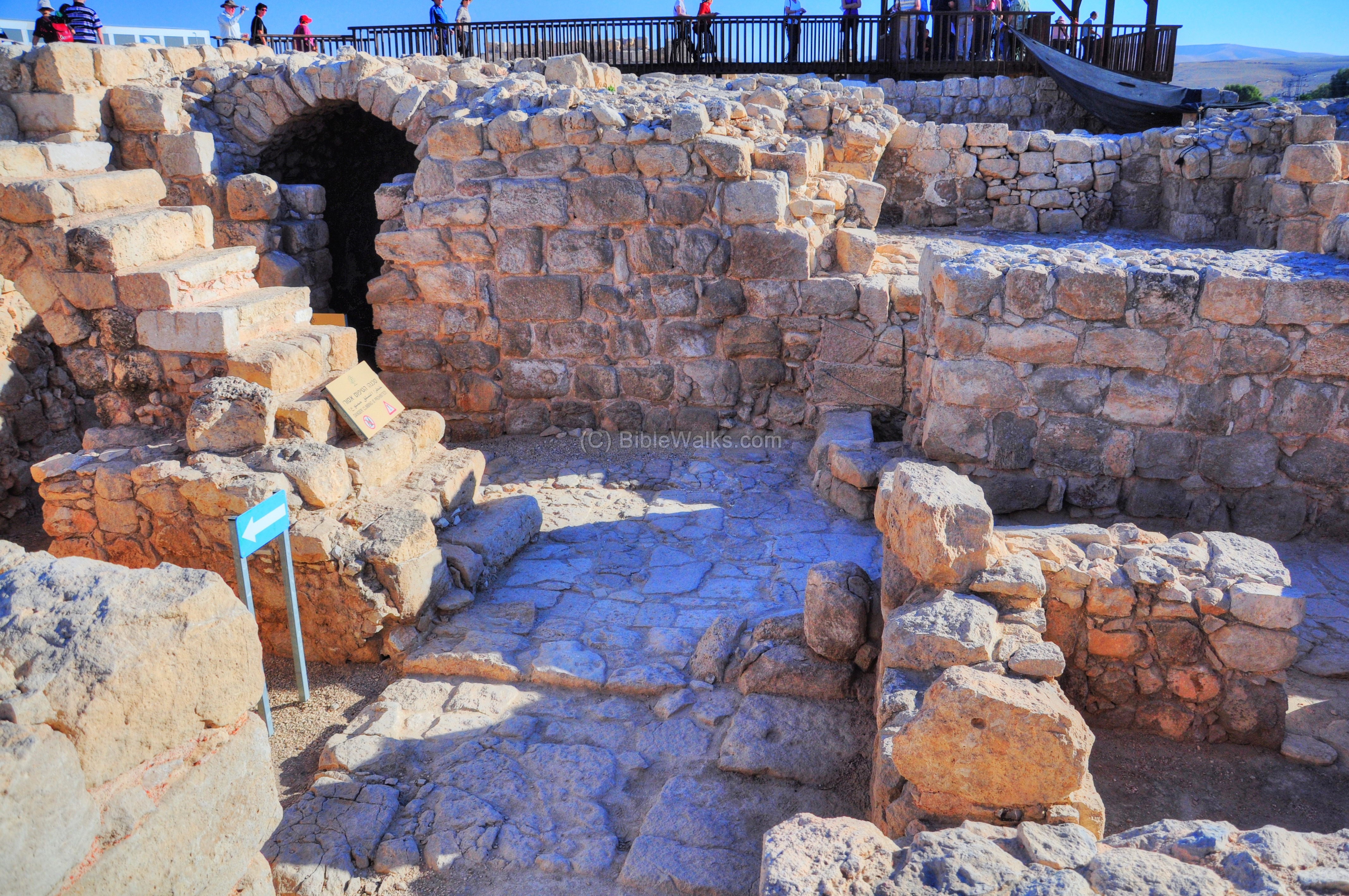
In one of the monks’ rooms, adjacent to the crypt, is a section of a mosaic floor, which was restored.
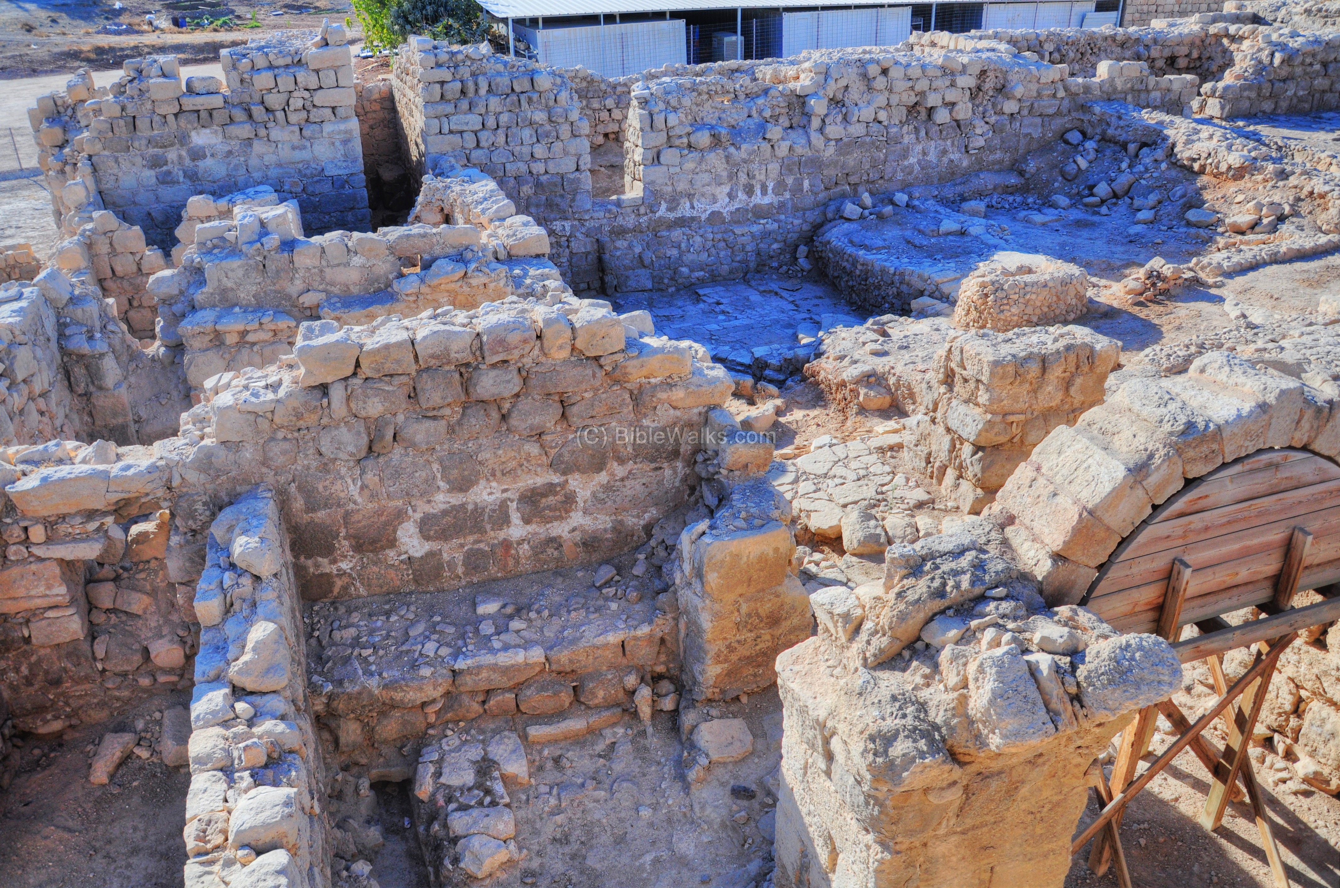
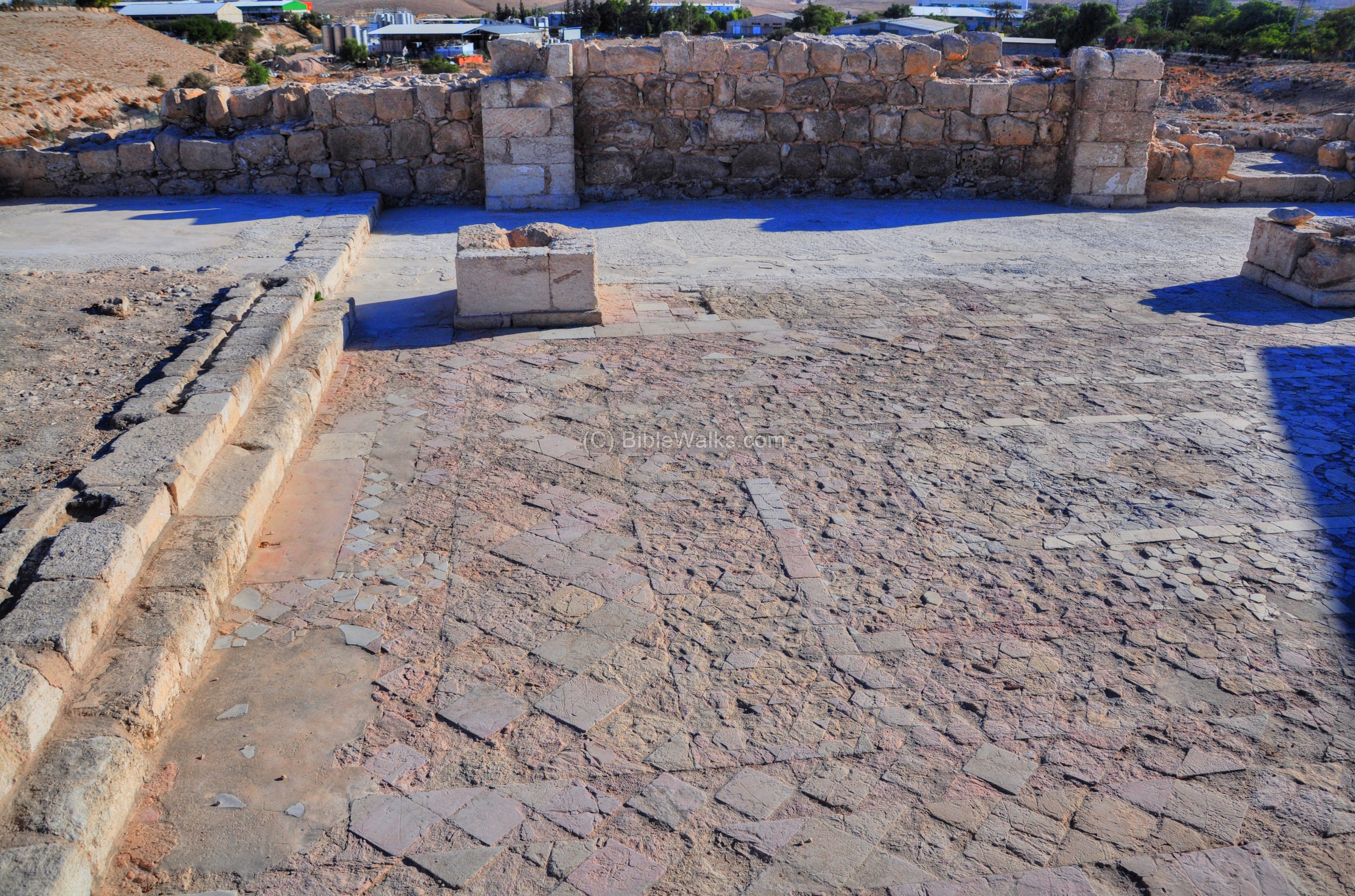
(h) Church
The Church rises above the southeast corner of the complex, as indicated by a red square on the plan. It is located on the second floor of the monastery.
The church is dated to the Arab and Crusaders periods, with several successive reconstruction phases. It was built over the ruins of the Church from the Byzantine period.
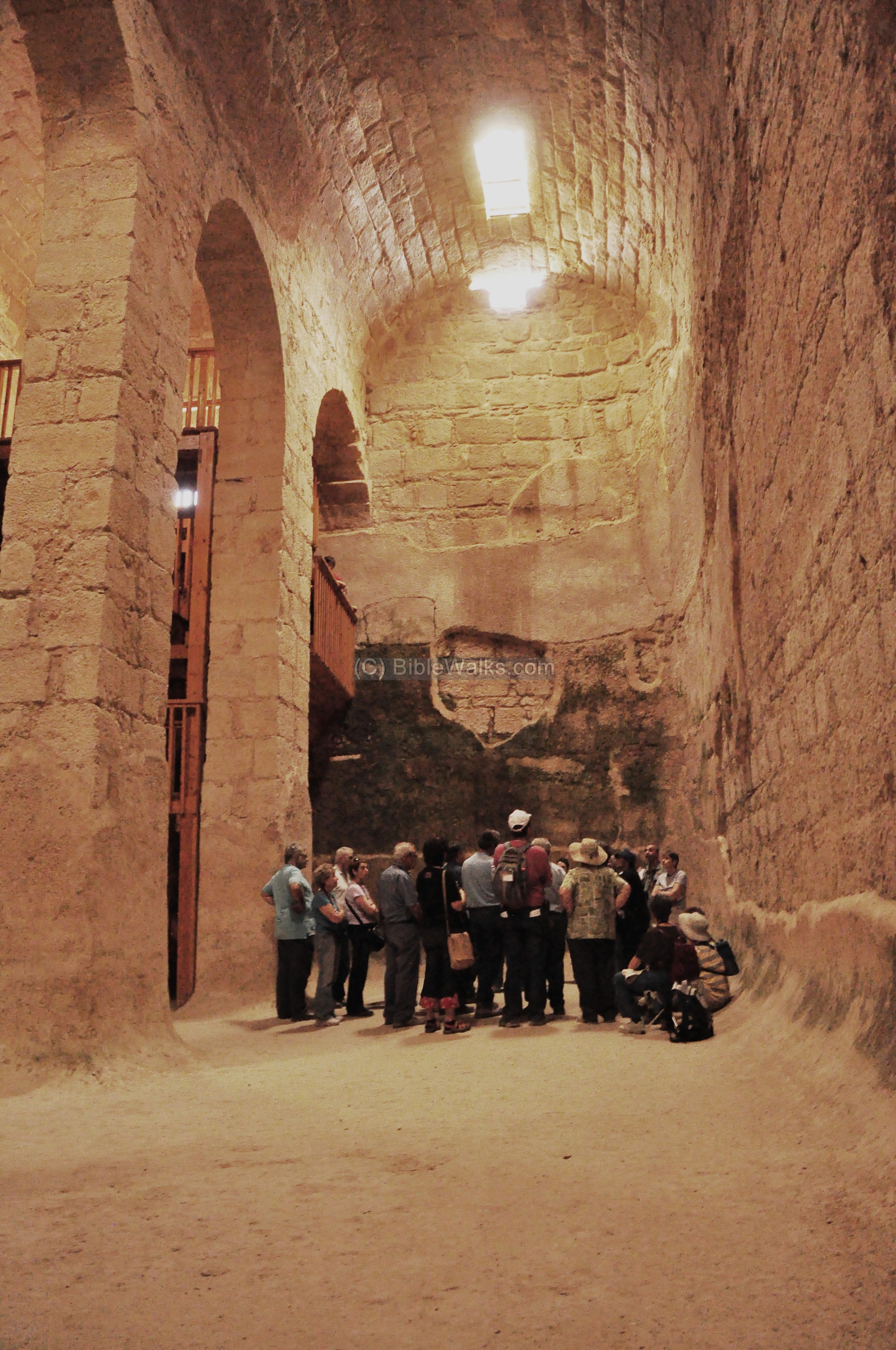
The floor of the church is built over the foundation of three massive vaults which ran parallel from the eastern wall towards the west. These vaults were probably built over the ruins of the Byzantine church built in 482, and perhaps also above the older church of the Laura (428) .
Each vault is 24m long, based on massive 1.8m walls. The large central vault (24m long by 4.9m wide, with a 3.2m high ceiling) functioned as the refectory (dining room for the monks). It was connected by a small passage to the southern vault which served as a pantry or kitchen, and was only 2.1m wide. The northern vault was also narrow, 2.1m wide.

The tri-apsidal Church, which was constructed just after the 659 earthquake, is located in the center of the monastery, adjoining its east wall. It is oriented to the east as all ancient Churches.
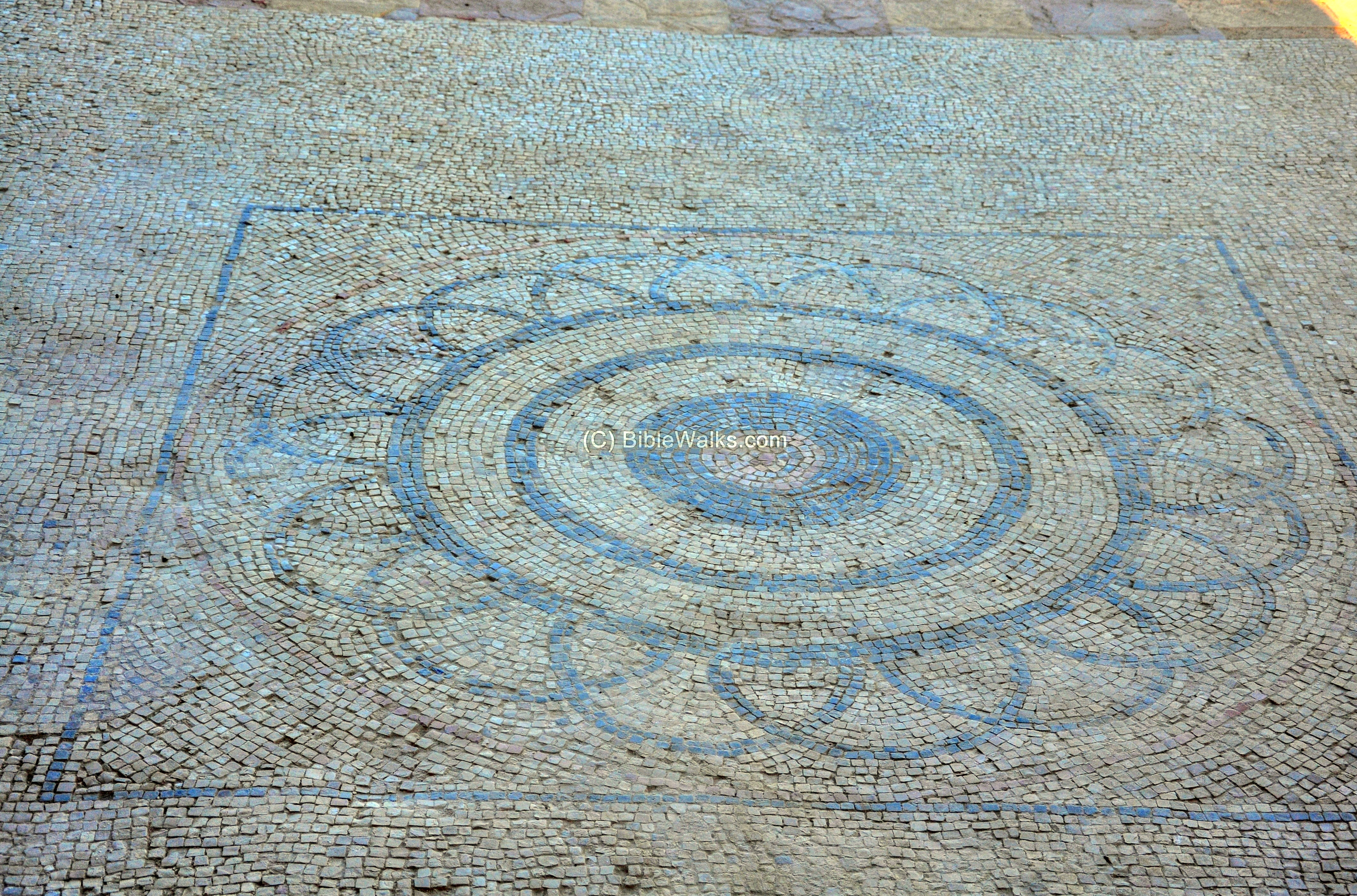
The floor of the church (25.4 x 13.8m) is paved with a beautiful stone mosaics. The inner space of the church was divided into two rows of square (1m x 1m) stone piers, with three piers in each row. Two of the eastern piers are seen in the following southern view. They supported a series of arches which held the vaulted stone roof, including a dome which was located just above this section.
The eastern section of the floor, seen below in detail, is of the type “opus sectile”, which is based on rough cuttings of various colored lime stones. This unique floor is dated to the Crusader period.
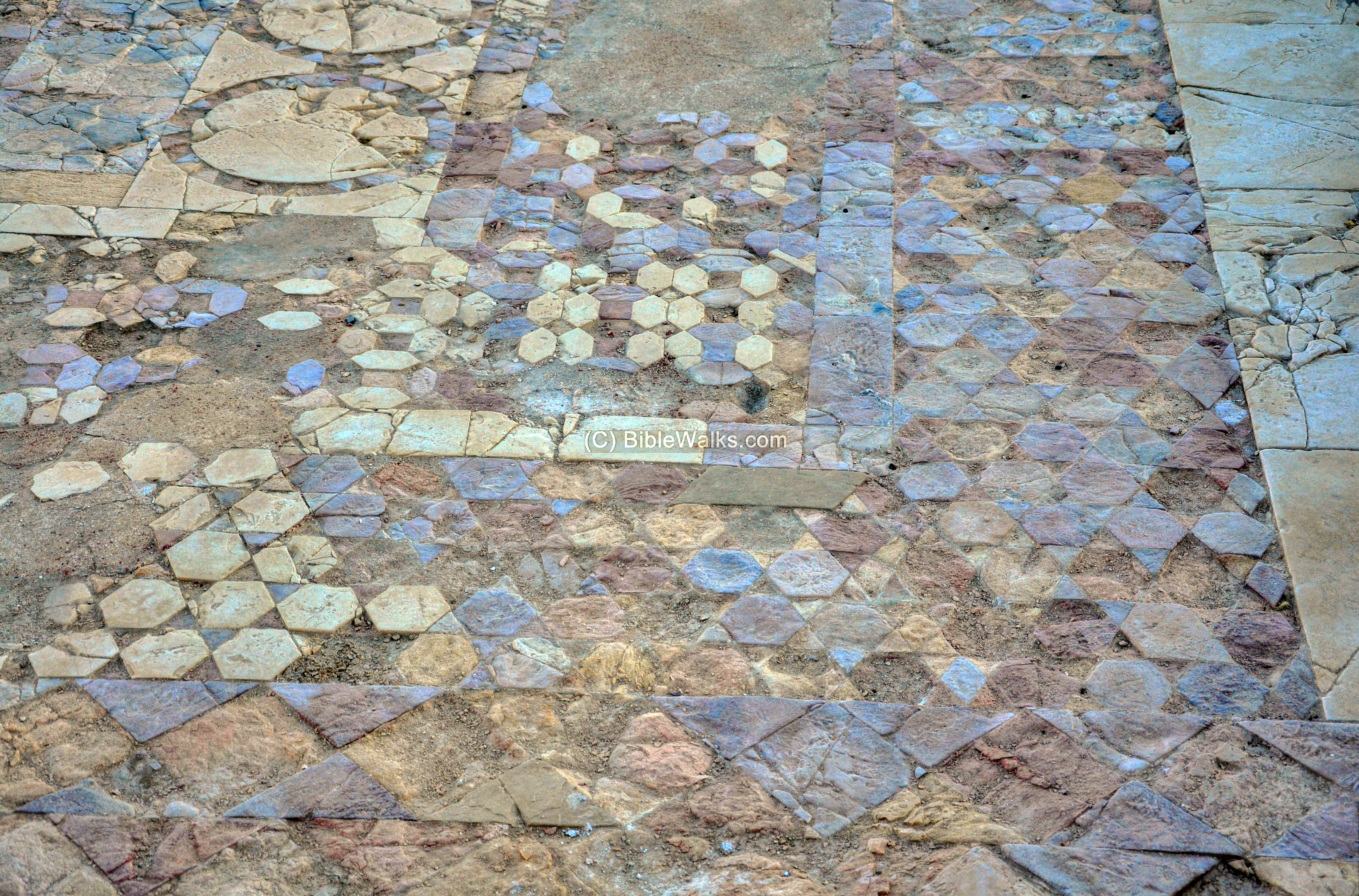
Another type of mosaic floor, with geometric patterns and small mosaic stones, is located on the western side of the floor. It is dated to the 7th C.
Standing on the edge of the church provides a great view of the monastery underneath it. In the following picture, you can see a small courtyard which is located on the north side of the church, reaching the wall above the crypt. A semicircular row of stones surround a window which illuminated the underground burial crypt.
In the far side of the picture is the entrance gate near the north-west corner.
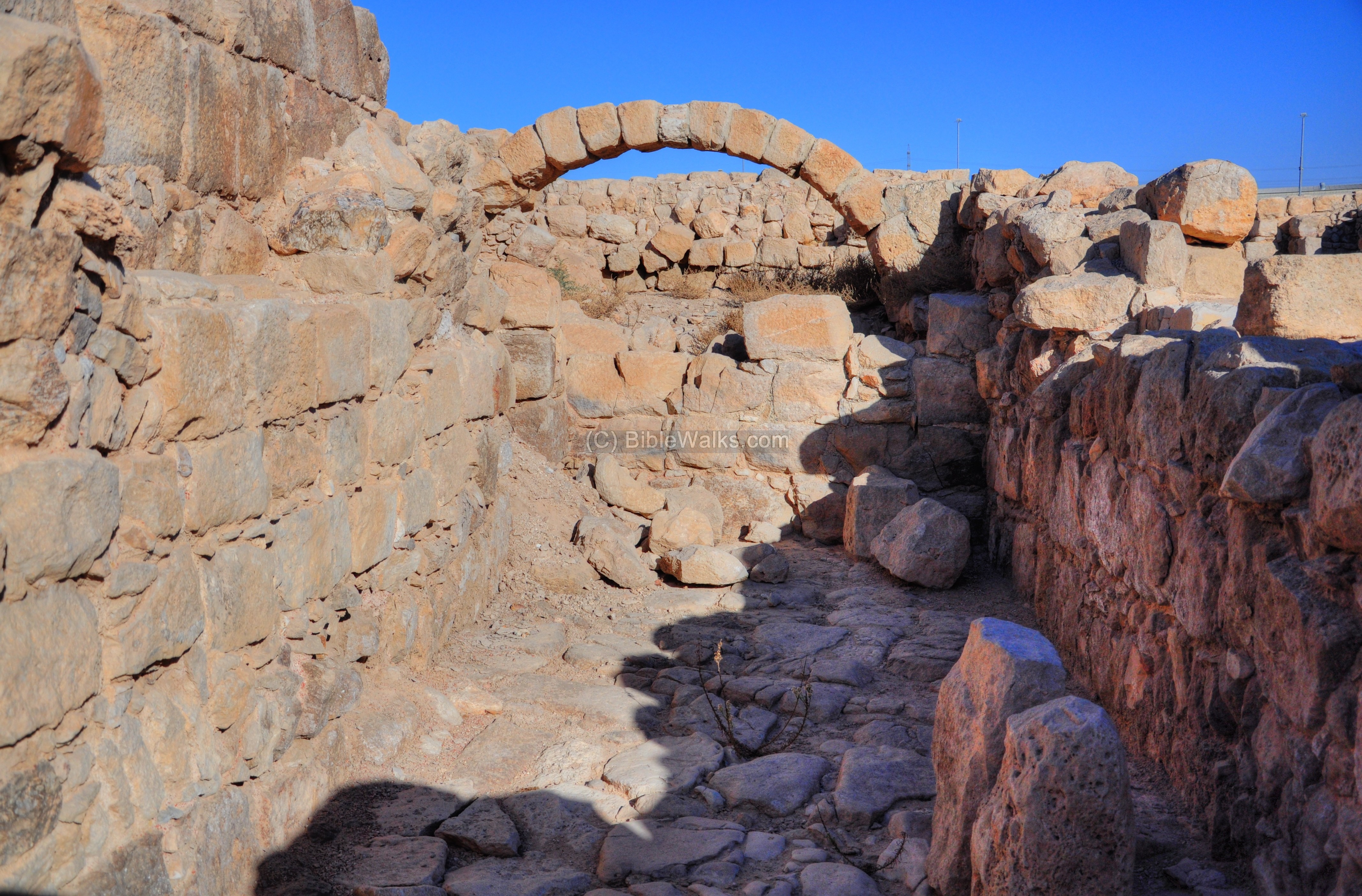
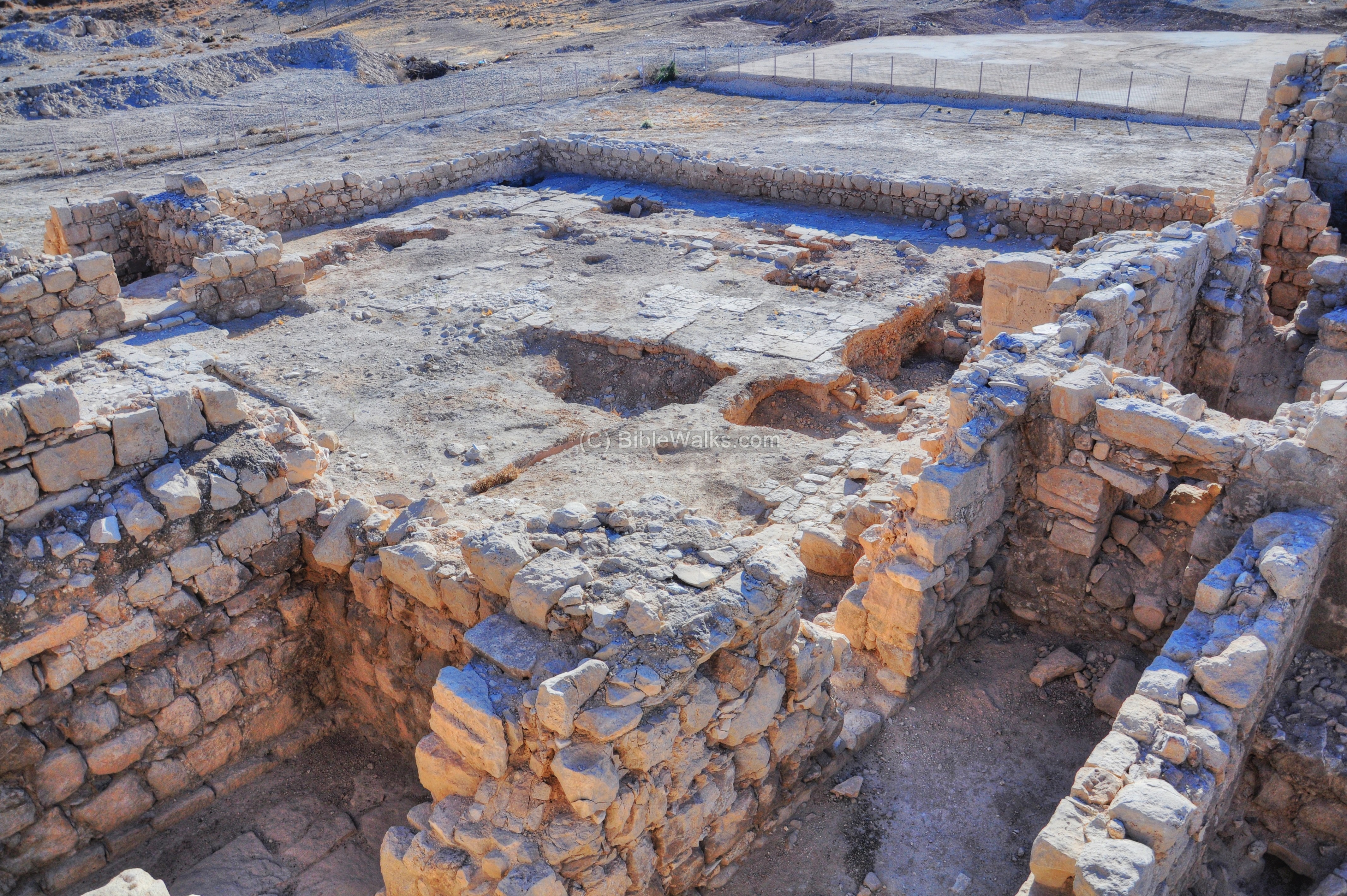
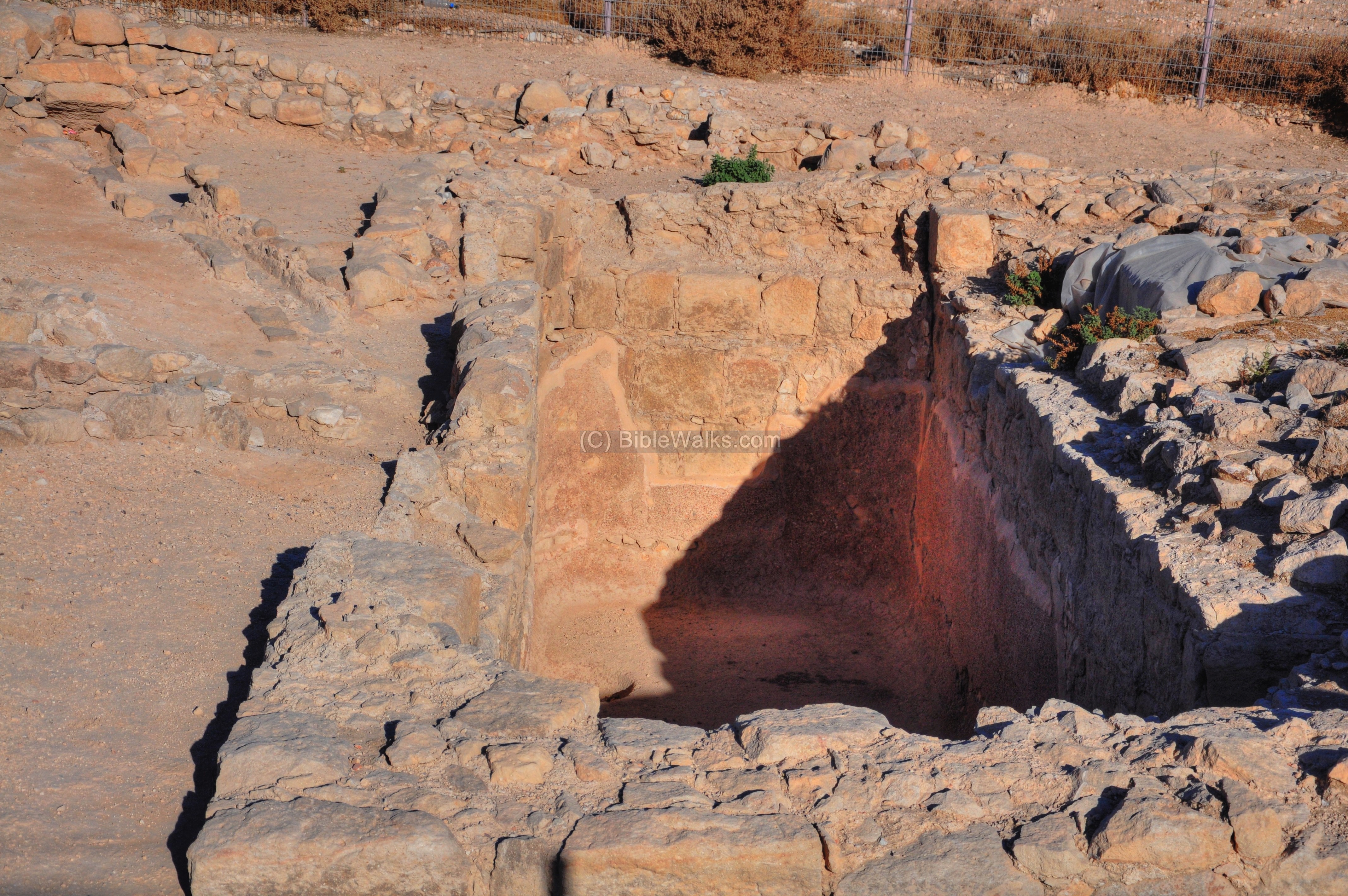
(i) Underground water cisterns
One of the major problems in the Judean desert is the lack of water. With only a few rainy days per year, the waters must be collected and stored so they can be used throughout the year.

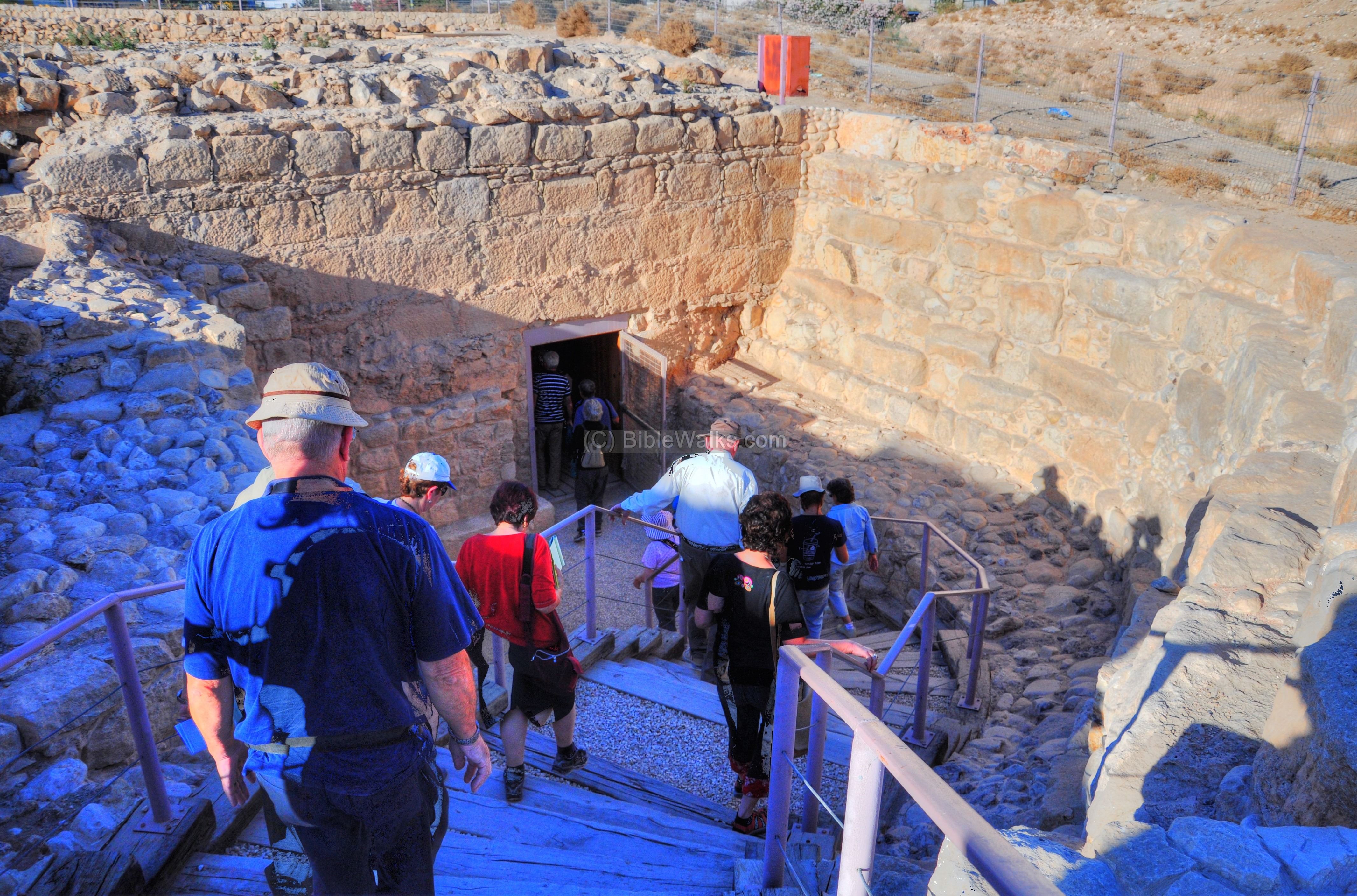
In Euthemius monastery there were four huge reservoirs which supplied the water for the monks, the pilgrims and the gardens. The largest on these cisterns is located east of the monastery walls (as indicated on the plan). It was cleaned and restored by the excavation team, and a staircase was added to allow an easy access to its bottom.
The north end of the structure, seen below, receives water from channels that fetch rain water from the hills on the north side. The pool is used to separate the soil from the water before it flows into the reservoir.
The entrance to the underground structure is from the south side, via a modern staircase. The reservoir is rectangular, 12m x 18m, and is more than 12m deep. Its total capacity is over 3000 m3.
Here, too, there are water channels that bring rain water from the rooftops of the Monastery, enter a collecting pool where they are filtered, then flow into the reservoir.
The interior of the reservoir is shown in the picture below. It is dated to 482 – when the coenobium was constructed.
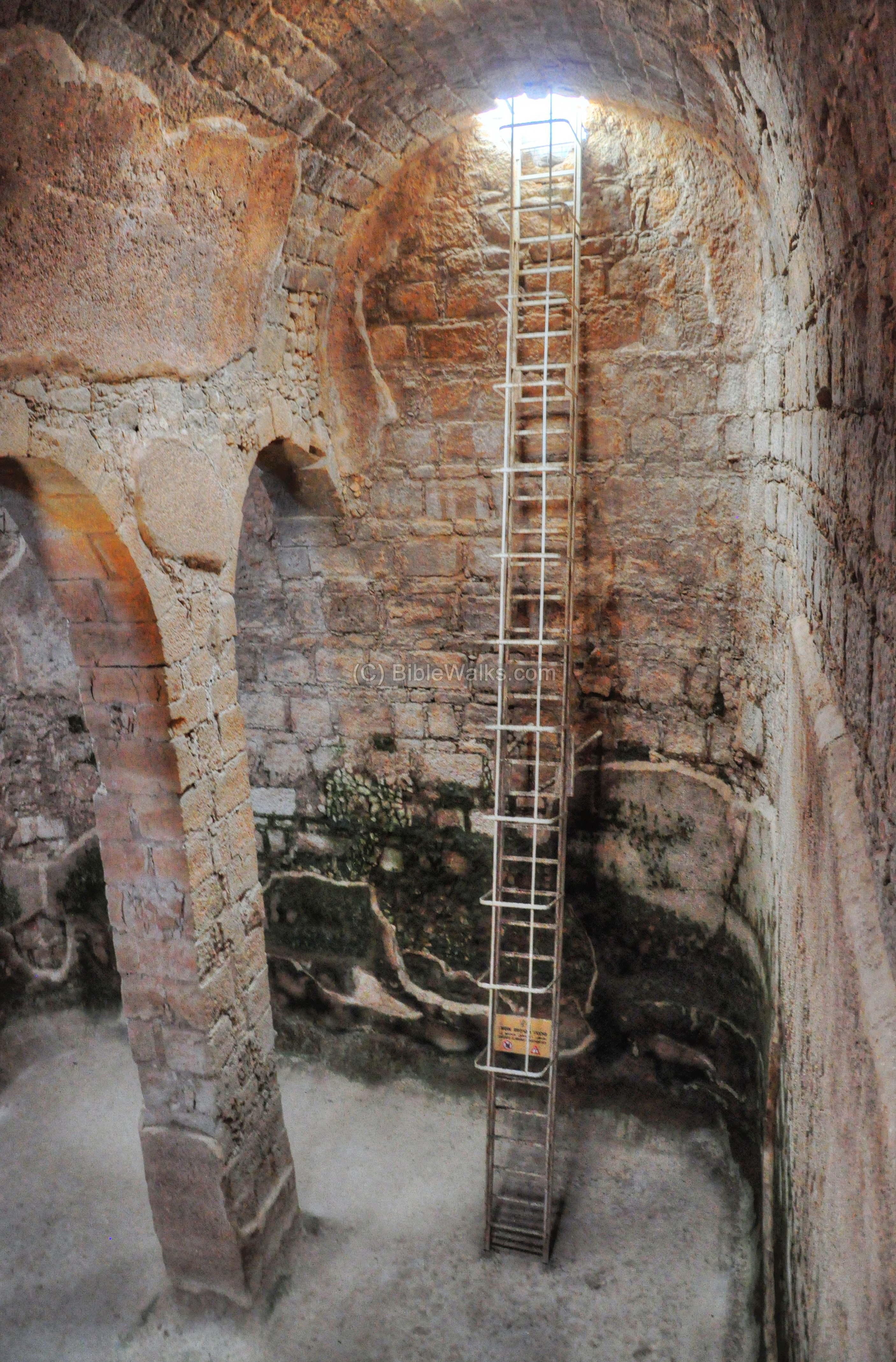
A modern staircase leads down to the bottom of the reservoir. Standing at the bottom of the cistern makes you appreciate the work invested in building this structure.
* * *
All in all, the visit to the Monastery of Euthymius “the Great” is unique and we highly recommend it.
Links:
* External Links:
- Euthymius and his monastery – Y. Hirschfeld (pdf, 33 pages) – a great article from the excavator of the site
* Internal links:
- Judea sites gallery
- Byzantine monks – info page on Monasticism
- Desert Water – in the Judean desert
- Drone Aerial views – collection of Biblical sites from the air
Etymology – behind the name:
* Monks:
- Monasticism is a religious way of secluded life. The word originates from Greek, based on the act of ‘dwelling alone’ (monos).
- Deir – Arabic: Monastery.
- Hermit – desert-dweller monk. Based on the Latin and Greek words ‘eremita’ and ‘eremites’ – of the desert.
- Laura (or Lavra) – cluster of caves or cells used by the hermits for seclusion, with a church as their weekly meeting center (usually on Sundays). The word is derived from Greek (meaning “a path”).
- Coenobium – a communal monastery, where a number of structures were surrounded by a wall and the monks lived there in a commune. This word is based on the Greek words Koinos (“common”) and Bios (“Life”).
* Names of the site:
- Khan el-Ahmar – The name of the site in Arabic (the red inn).
- Khan – Arabic: hostel, inn.
- Ahmar –Arabic: Red (based on the word Adummim – red).
* Names of Adummim:
- Adom – Hebrew: Red.
- Adummim: reds.
- Ma’ale Adummim – Hebrew: Red Ascent or Red Heights. This is the area above Nebi Musa, named after the red hills. In Biblical times it was a landmark the north-east border of Judah (Joshua 15:7): “before the going up to Adummim…”. Ma’ale Adummim is also the name of the city on the eastern suburbs of Jerusalem, which was established in 1991, and named after the Biblical place.
- Mishor Adummim – Hebrew: Mishor is “plains”. This is the name of the industrial zone in Ma’ale Adummim, and a settlement established in 1975.
BibleWalks.com – walks with the Bible
Mar Saba<—–previous Judean site——<<< All Sites >>> —next Judea site—> Martyrius
This page was last updated on June 24, 2017 (Added aerial views)
Sponsored links: